The Tranquility II left Rudesheim during the lunch hour and

shortly we were on the outskirts with vineyards occupying the slopes leading up to the Niederwald Monument.

As noted in my last entry, you can visit the monument by taking the little two passenger cable cars out of Rudesheim. They glide you over a piece of the old town and several vineyards to deposit you high on the hill near the huge statue. I'm sure the view looking down and out over the Rhine is just as spectacular as the one we had looking up from the ship.The monument was constructed to commemorate the foundation of the German Empire after the end of the Franco-Prussian War. It was completed in 1883.

From here on the river just continues to roll on through green hills and vineyard after vineyard..


Every river bend or so the view is punctuated by quaint well kept little towns that seem to hug the waterfront like colorful sentinels protecting the enclave's unique identity.

Niederheimbach, runs a pint sized ferry that links roads and paths on both sides of the river.

Leaving Neiderheimbach the hills begin to close in and climb higher.

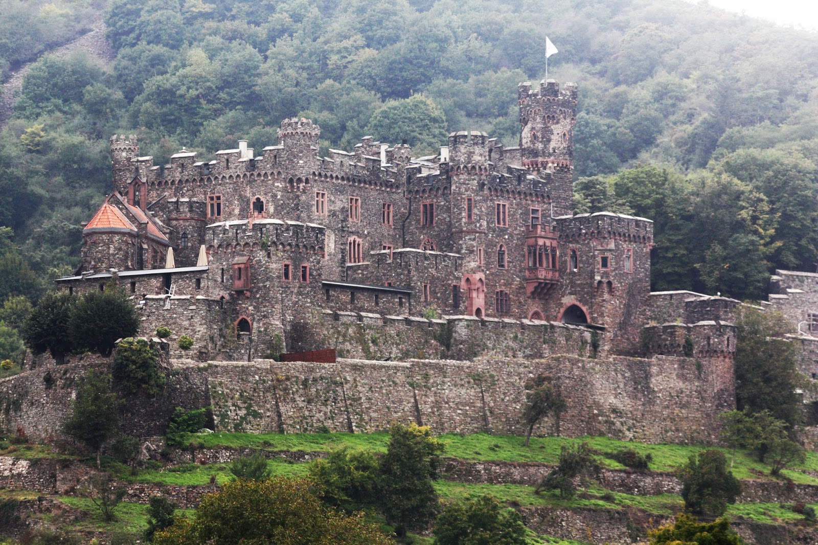
Castles start appearing and come so fast it is hard to identify them. Some are just glorious ruins; others are still occupied by wealthy families; and many are now fancy restaurants or hotels. Seeing them from the river is ideal for looking, but there are other options. Rail lines and roads run on both sides of the river making ground based itineraries just as convenient.

I believe this is Rheinfils Castle dating from 1245 and now undergoing some major renovation.

Defense is prime on this large complex. You can clearly see three separate perimeters that would have to be fought through before you reach the central keep.
As the hills rise higher and the river narrows, the traffic gets more bunched up. .

We were approaching the once deadly Rock of the Lorelei. At this narrow point the currents used to be treacherous and it was here that many early sailors were lured to their doom on rocks or eddies. The famed rock is just that--a 400 foot slate cliff overlooking the river that has been pinched down to about 370 feet wide. It was already known as the most dangerous point on the river as early as the middle ages.

At the base of the cliff is this commemorative sign. spelled a bit differently, but looking quite benign. The legend has gone through numerous variations over time, but most of the stories center on a beautiful jilted maiden who threw herself off the top of the cliff as her former lover deserted her. A river god took pity and transformed her into a siren who forever after sat atop the mount and sang while combing her long golden tresses. This, of course, distracted boatmen in the dangerous waters below and sent them crashing on rocks to their watery doom.

Well, we have negotiated the narrows safely. Not one strange terrifying song or mysterious echo wafted down upon us from the hard slate surface. Our modern cruise ship glided smoothly past without moral distraction much less the loss of passengers or crew.

We were now free to resume our castle watching. Marksburg near Braubach is particularly attractive as its white walls cap the top of a hlll rather than nestling into a slope. .


This feller slipped by so fast we didn't get the name.

The vineyards never stop either. How they work these slopes is nothing short of amazing.

Mechanization, other then the small tracks for vehicles, is simply not possible in this terrain


The vines continue to be planted, cultivated, and picked by hand in much the same way it was done all the way back to Roman times.

Castles, like wine, seem to come in myriad forms, locations, and colors. Oberwesel has a striking white toll castle (dating from the 1300's) called Pfalzgrafenstein. It sits on a small island right near the riverbank. Gautenfels or Kaub Castle can be seen on the hill.overlooking the town.

I suppose we shouldn't be reminding folks in the present day about the river as main sewage canal, but here we are looking at the castle's privies called Garderobes. They operate with total flushless efficiency with an open drop to the moving river below. No treatment needed and no worry except for the next community downstream. I wonder if they might also have been used to discourage sailors from trying to run the gauntlet without paying the toll.

Not too long after we passed the Loreli Rock the hills began to recede and the river widened its course once again.

Shortly a much larger town appeared and here we are sliding into our mooring in Koblenz. .

The Florinskirche welcomes strollers and we were off on a before dinner walk that will be covered in the next entry.


No comments:
Post a Comment